

These plans are final. If there are any significant unplanned changes or additional information, members will be notified by email.
Please be at the OC Lodge at 07:45 AM for an 08:00 AM departure.
We will line up in 2 or three lines like we did for Larry's Lake Tahoe trip. I will lead the first group, Jerry Johnson will lead the second group, if a third group is needed, the leader will be TBA. Click on the following 6 links to see the latest information. I will bring one paper copy per car including a cell phone list to the departure.
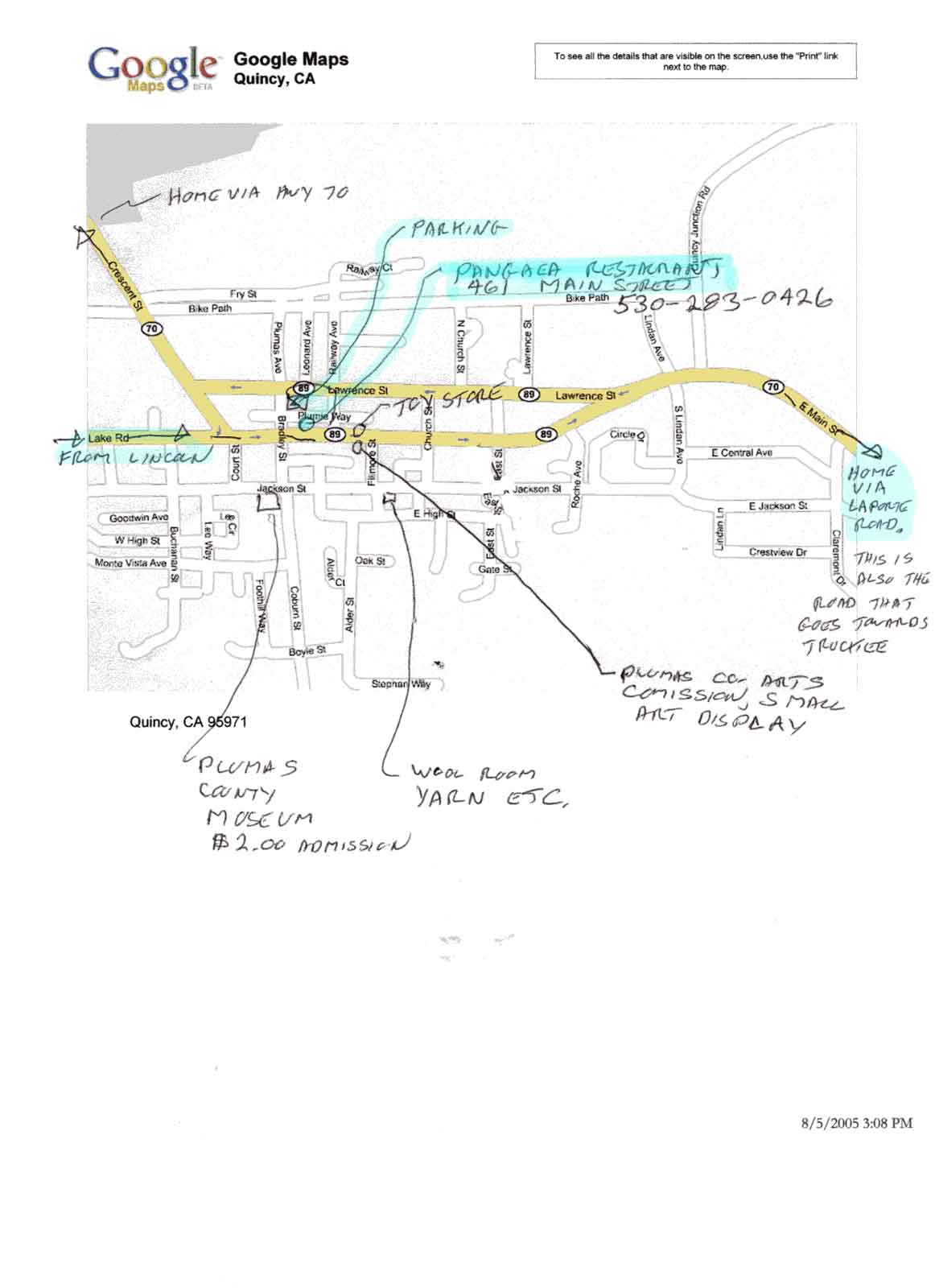
The Restaurant is Pangaea on Main Street in Quincy. Meals run about $7 to $10, drinks extra. They are expecting our group and we will have an area to sit together.
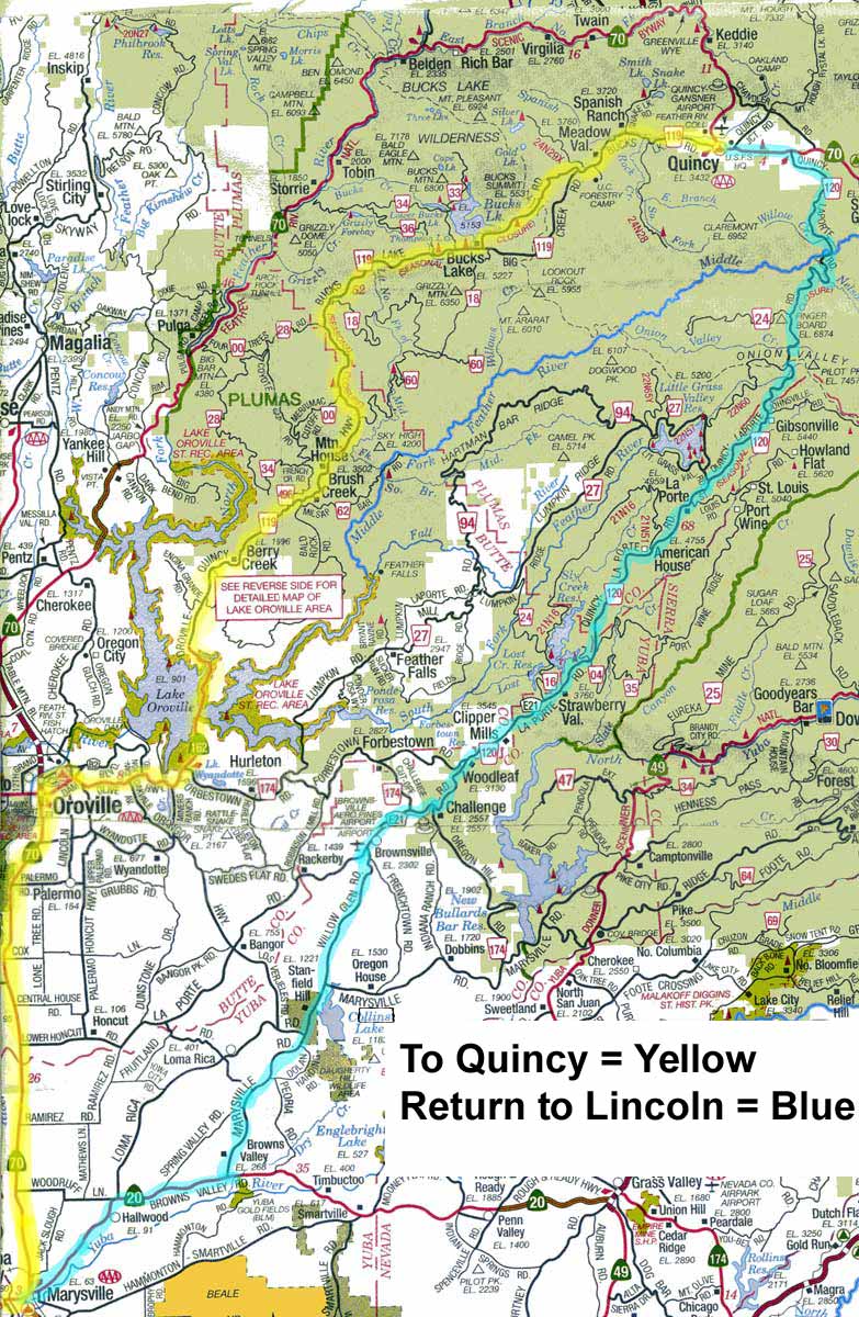
To QuincyThe roads are in good condition, there was some construction work on the road to Quincy in late June (Oroville-Quincy road). According to the flagman, that work would be done by the time of our trip. There will be a coffee, etc. stop in Oroville about 1 hour 15 minutes into the trip. Downtown Oroville has a couple of nice coffee shops with nearby parking that can accommodate a large group in one lot. Oroville to Quincy is the heart of the trip to Quincy with 60 miles of twisty but not too twisty road. It's roughly comparable to Highway 49 from Nevada City to Downieville except with a lot less traffic! There are two great back roads to Quincy. The plan is to travel from Lincoln to Quincy, about 120 miles, via: |
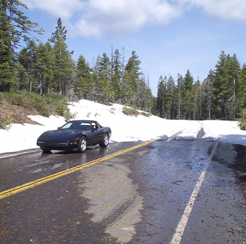
The snow is long gone.
|
|
Oroville - Quincy Road goes around the east side of Lake Oroville and past Bucks Lake. It's a fun, scenic, moderately twisty two-lane road with pavement that's in good to excellent condition. There is little traffic on the road. It climbs to about 5800 feet, and then drops down into Quincy at 3,400 feet, a good elevation for August, and typically 8 to 10 degrees cooler than Lincoln. |
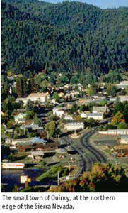
At QuincyWe will arrive in Quincy about 11:30 is there are no delays or extended stops, lunch is planned for 12:00 I plan to meet the group returning via LaPorte Road at the parking lot on the Quincy map at 2:00 PM. That will give us time for a leisurely lunch and a little sight seeing/shopping in Quincy. The Quincy map shows some points of interest such as the Museum, yarn store, toy store and art gallery. |
 |
|
the other backroad route back to Marysville. It is in better condition now than described and shown in the following link. The pavement on LaPorte Road is generally very good except on the lower end toward Marysville, but it's still tolerable in a stiffly sprung C4 Corvette. Porsche pilots won't even notice the small amount of roughness. We can expect some construction on the return road (LaPorte Road) with traffic delays in one spot. Maximum delay was up to 1/2 hour. The road was clean and not a hazard to pristine sports cars. LaPorte Road has more miles of twisty road than the other road because it comes back to civilization closer to home. It is still about the same total distance from Lincoln Hills, 120 miles. LaPorte Road climbs to 6,500 feet. For those who have had enough boondocks roads for the day, there is Highway 70 from Quincy back to Oroville and on home via Marysville. It's a few miles further than the other two roads, at about 130 miles, but it's a major two lane state highway. It's follows the Feather river most of the way from the summit to Oroville and has mile after mile of great scenery. |
Some may want to consider going south out of Quincy on Hwy 89 towards Truckee. It's an even longer but good route home and you get on Interstate 80 at Truckee at . The AAA Northern California map covers the route from just south of Oroville north. The AAA Central California map covers the southern part of the return route via LaPorte Road and a couple of miscellaneous roads to Highway 20. |