All current LHSCG members are invited on an impromptu Sports Car trip in late August. The exact date will be in an email sent to you.
As with a regular LHSCG trip, this trip is limited to qualified Sports Cars.
Expenses and mileage: The total round trip driving distance via the main route is about 145 miles and will take 5 to 6 hours, depending on how long you stay in Placerville. Lunch at the Hang Town Grill should be under $10, their hamburgers are outstanding and I have heard their salads are also good. Lunch will be at about 1:00 PM
Please notify me if you would like to come and let me know whether one or two people will be in your car and how many want to have lunch with the group at the Hangtown Grill.
Some of us will be using FRS or GMRS radios on Channel 6, no privacy code. Please feel free to join us on the air.
Please be at the north end of the OC Lodge parking lot at 09:45 AM for the pre-departure meeting and 10:00 AM departure.
If we have over 7 cars, we will line up in 2 lines of up to 6 cars each. I will lead the first group, Some other lucky volunteer will lead the second group. The second group will travel at a bit slower pace. Pick the group you want to be in and line up behind the leader. If more the 6 cars are in a group, we will need volunteers to switch groups to balance things out.
I will bring one paper copy of the route directions and cellphone numbers for each person who has signed up 3 days before the trip. You're on your own for maps.
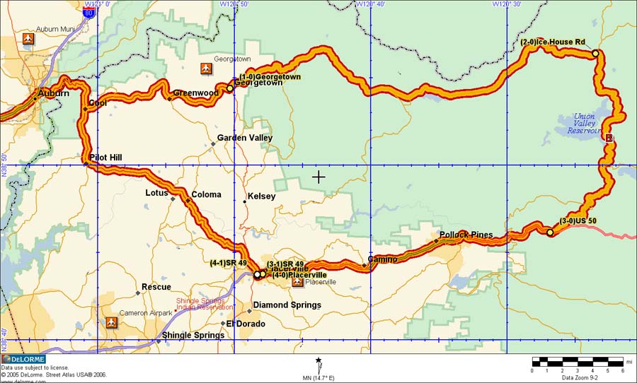
Mary Ann and I did a dry run on August 14th. Total distance is 145 miles compared to 250 miles for the Quincy trip. The roads are in very good condition and are full width 2 lane blacktop. The roads, and I think the scenery are better than the Quincy trip, but scenery is subjective, so come see for yourself.
There will be a 30 minute coffee, etc. stop in Georgetown about 50 minutes into the trip at the Sisters Cafe a downtown Georgetown coffee shop. As soon as you turn left onto Main Street there is parking in the middle of the street (really, there is) and alongside the road. Sisters is more of a Coffee Shop and Corner Kitchen next door is a small regular resturant, but does have decent coffee to go.
After Coffee we will head north-east for 31 miles on Wentworth Springs Road, climbing from 2,900 feet elevation in Georgetown to 6,100 feet shortly before Icehouse Road. The road is a smooth full width road that winds through the mountains with well forested scenery and views of mountains off in the Distance. We will stop about mid-way at a scenic stop by a lake. There may be toilet facilities there.
Ice House Road has even better scenery than Wentworth Springs Road and is also in very good condition. We will be on Ice Hose Road for about 22 miles to Highway 50, with a brief stop at a Forest Service Information station on the way.
From Highway 50 it's 22 miles to Spring Street where we will turn left and go to Main Street. See the route spreadsheet for parking suggestions.
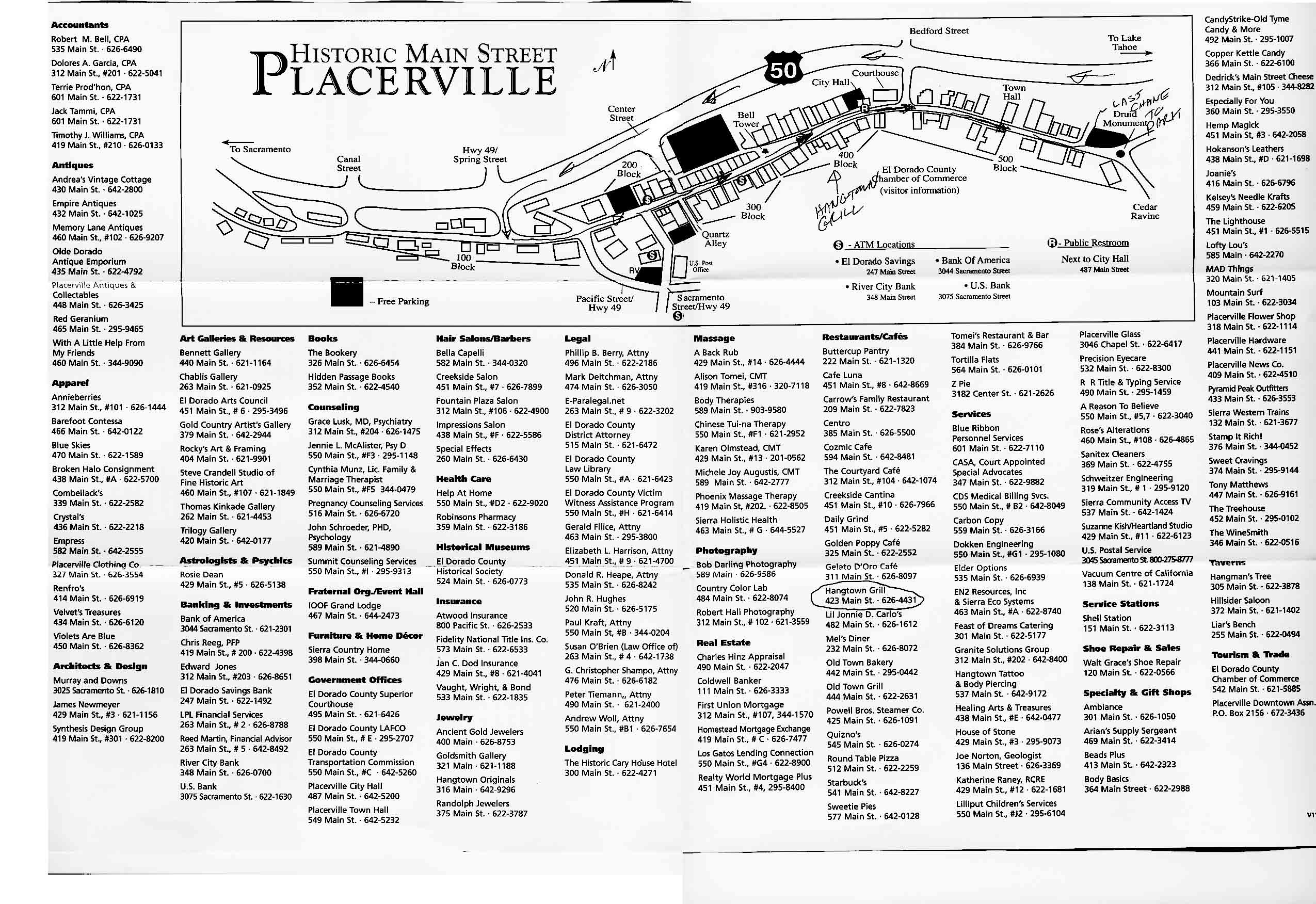
Some of us will be having lunch at the Hangtown Grill at 444 Main street. If you would like to join us, please let me know when you sign up for the trip. I will call ahead and reserve a table when we are near the cell tower disguised as a big tree near the end of Ice House Road.
Here's a link to a map of downtown Placerville. Please print your own copy if you want one. You may want blow it up and print it on 2 sheets of paper or bring a magnifying glass.
Two hours after we arrive in Placerville, I will be leaving for home via Hwy 49 through Auburn. See the Placerville map for the lot I plan to park in. Any one who cares to join me is welcome. If you are ready for non-twisty roads, take Hwy 50 towards Sacramento and there is an easy route that starts near Folsom.My email address is dbrewste at yahoo.com. Replace the " at " with an @.