22 July 2006
Changed departure time
Changed Lunch Location
Updated Trip Directions
Quincy Backroads 2006
Quincy Backroads 2006
Dick Brewster
The August 2006 LHSCG trip to Quincy is a day trip via some beautiful backroads. The exact date is listed in the group meeting minutes and emails I have sent to members.
These plans shouldn't change much, if they do everyone who is signed up for the trip will be notified by email
Expenses and mileage: The total round trip driving distance via the main route is about 250 miles. Lunch will be about $9 to $12 plus beverages and if you choose to go to dinner with us, it will be about $18 to $25 plus beverages. Also figure on one coffee stop each direction.
Some of us will be using FRS or GMRS radios on Channel 6, no privacy code. Please feel free to join us on the air.
Please be at the north end of the OC Lodge parking lot at 08:15 AM for the pre-departure meeting and 08:30 AM departure.
We will line up in 2 lines of up to 6 cars each. I will lead the first group, Virgil Berry will lead the second group. The second group will travel at a bit slower pace. Pick the group you want to be in and line up behind the leader. If more the 6 cars are in a group, we will need volunteers to switch groups to balance things out.
Click on the following 6 links to see the latest information. I will bring one paper copy of the essential information per car, including a cell phone list to the departure.
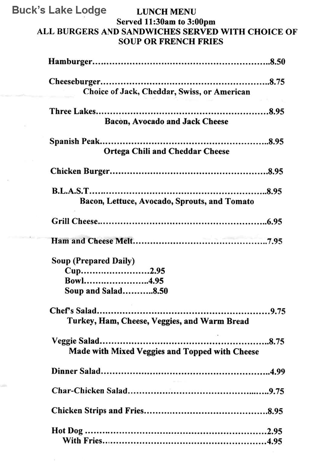
The lunch restaurant is Buck's Lake Lodge at Buck's Lake. Meals run about $9 to $12, drinks extra. They are expecting our group and we will have an area to sit together.
The roads were in good condition last year. We will make a dry run in late July for a road condition check.
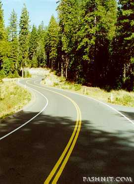
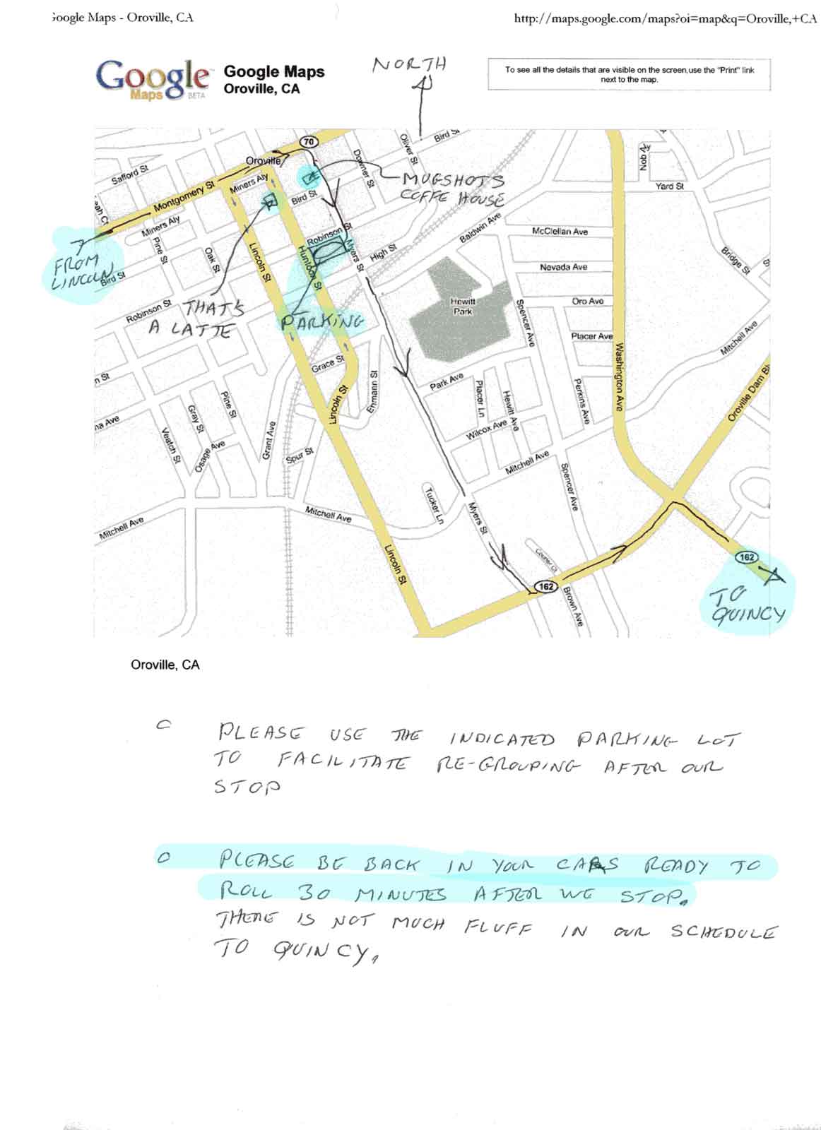
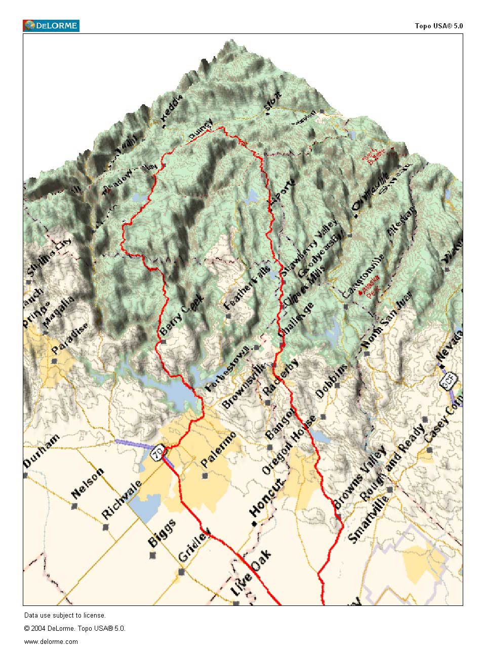
There will be a coffee, etc. stop in Oroville about 1 hour 15 minutes into the trip at Mugshots, a downtown Oroville coffee shop. We can all park in a nearby free city parking lot. From Oroville to Quincy is the heart of the trip to Quincy with 60 miles of twisty but not too twisty road. It's roughly comparable to Highway 49 from Nevada City to Downieville except with a lot less traffic!
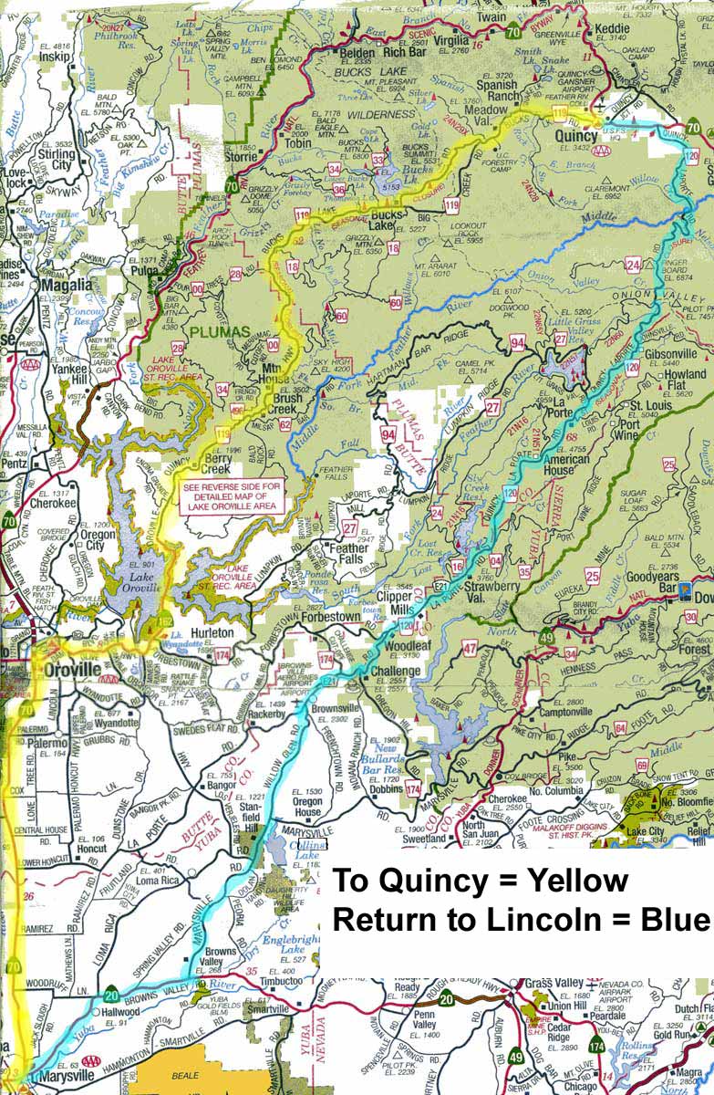
There are two great back roads to Quincy. The plan is to travel from Lincoln to Quincy, about 120 miles, via:
Hwys 65 & 70 to Marysville
Hwy 70 to Oroville
Oroville - Quincy Road and Buck's Lake Road to Quincy.
The snow is long gone.
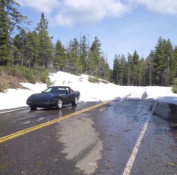
2 May 2005 @ 5200 feet elevation, 27 miles short of Quincy .... Nice car.
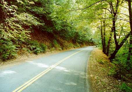
Oroville - Quincy Road goes around the east side of Lake Oroville and past Bucks Lake. It's a fun, scenic, moderately twisty two-lane road with pavement that's in good to excellent condition.
There is little traffic on the road. It climbs to about 5800 feet, and then drops down into Quincy at 3,400 feet, a good elevation for August, and typically 8 to 10 degrees cooler than Lincoln.
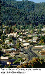
At Quincy
More Quincy Backroads Links
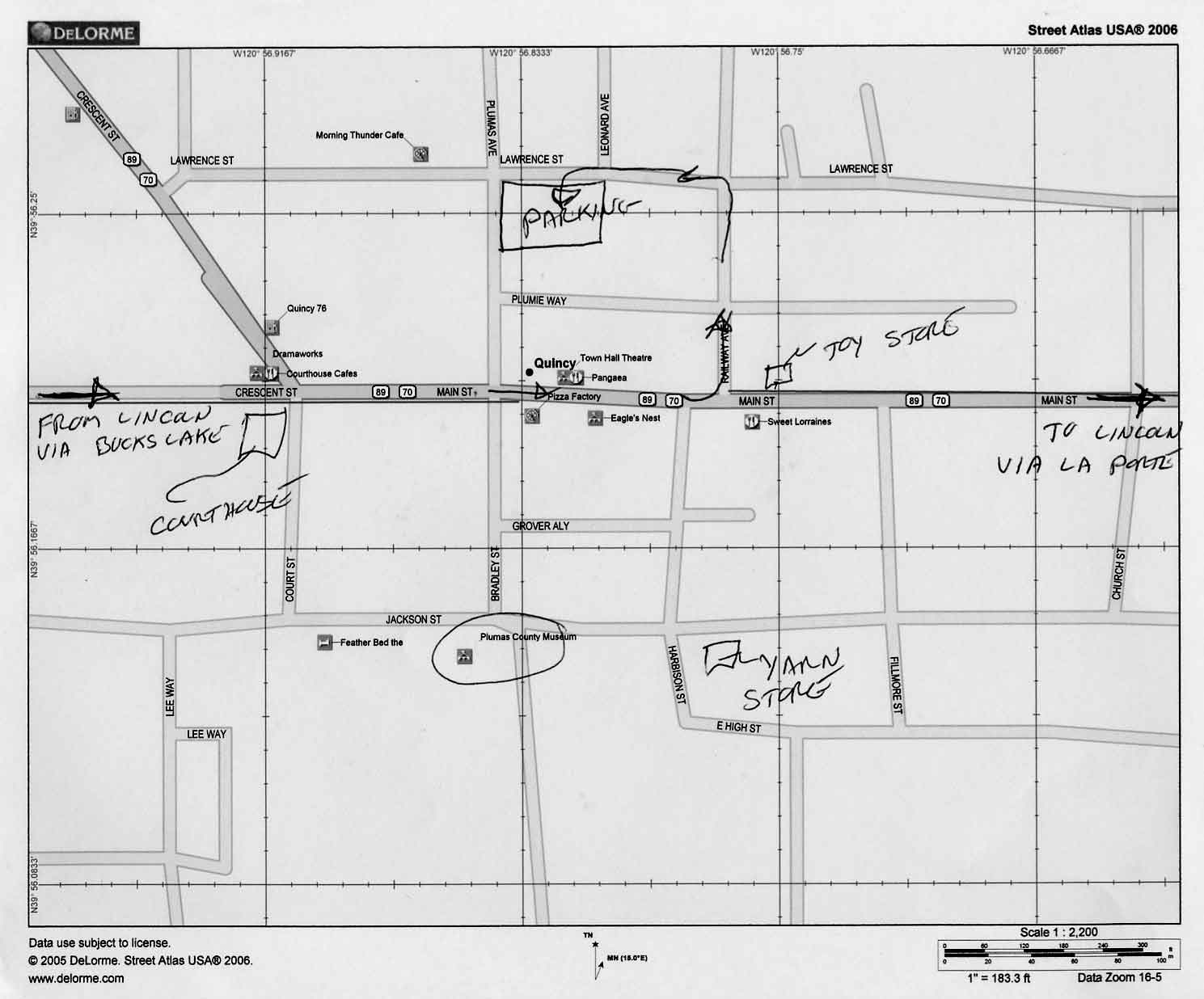
We will arrive in Quincy about 1:30 PM and spend about an hour there.
I plan to meet the group returning via LaPorte Road at the parking lot on the Quincy map at 2:00 PM.
That will give us time for a leisurely lunch and a little sight seeing/shopping in Quincy.
The Quincy map shows some points of interest such as the Museum, yarn store, toy store and art gallery.
The Route home
After Lunch, we will do the typical LHSCG thing and split up. I will lead the hardy souls home over LaPorte Road,.....
the other backroad route back to Marysville. It is in better condition now than described and shown in the above link. The pavement on LaPorte Road is generally very good except on the lower end toward Marysville, but it's still tolerable in a stiffly sprung C4 Corvette. Porsche pilots won't even notice the small amount of roughness.
Mary Ann and I drove La Porte road in early June and there was no construction work in process.
LaPorte Road has more miles of twisty road than the other road because it comes back to civilization closer to home. It is still about the same length drive home, 120 miles. LaPorte Road climbs to 6,500 feet.
For those who want to, there will be a dinner stop at Salute Italian Restaurant,
628 Plumas Street in Yuba City. Please notify the trip leader if you plan to join us at Salute.
For those who have had enough boondocks roads for the day, there is Highway 70 from Quincy back to Oroville and on home via Marysville. It's a few miles further than the other two roads, at about 130 miles, but it's a major two lane state highway. It's follows the Feather river most of the way from the summit to Oroville and has mile after mile of great scenery.
Some may want to consider going south out of Quincy on Hwy 89 towards Truckee. It's an even longer but good route home and you get on Interstate 80 at Truckee.
The AAA Northern California map covers the route from just south of Oroville north. The AAA Central California map covers the southern part of the return route via LaPorte Road and a couple of miscellaneous roads to Highway 20.